Cumbre bandera
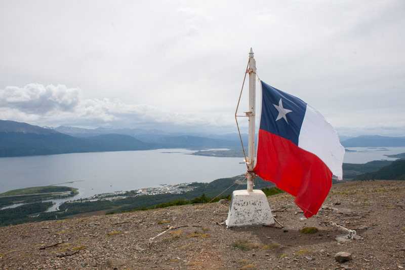
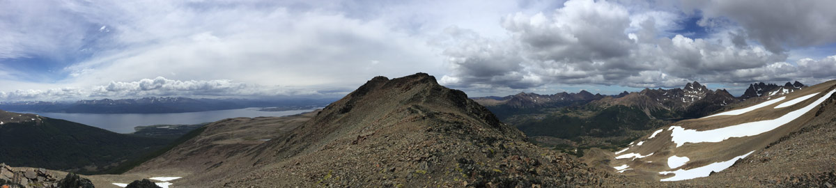
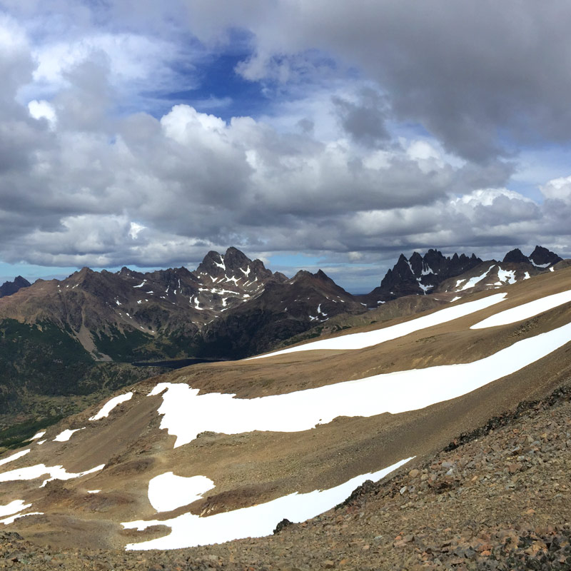
A sporty stroll to the Cumbre Bandera summit, which offers a panoramic view of the Dientes de Navarino, the Beagle and the Ukika Valley.
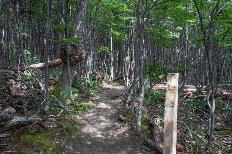
The start of the hike corresponds to the Dientes de Navarino circuit. You must follow the path with red and white markings that starts on the left (east). After a first section with a series of footbridges and wooden bridges you will arrive at a spring on your right where it is possible to take water. The next water point is 5km away. At 2.7km you will find a viewpoint with a panoramic view of the beagle.
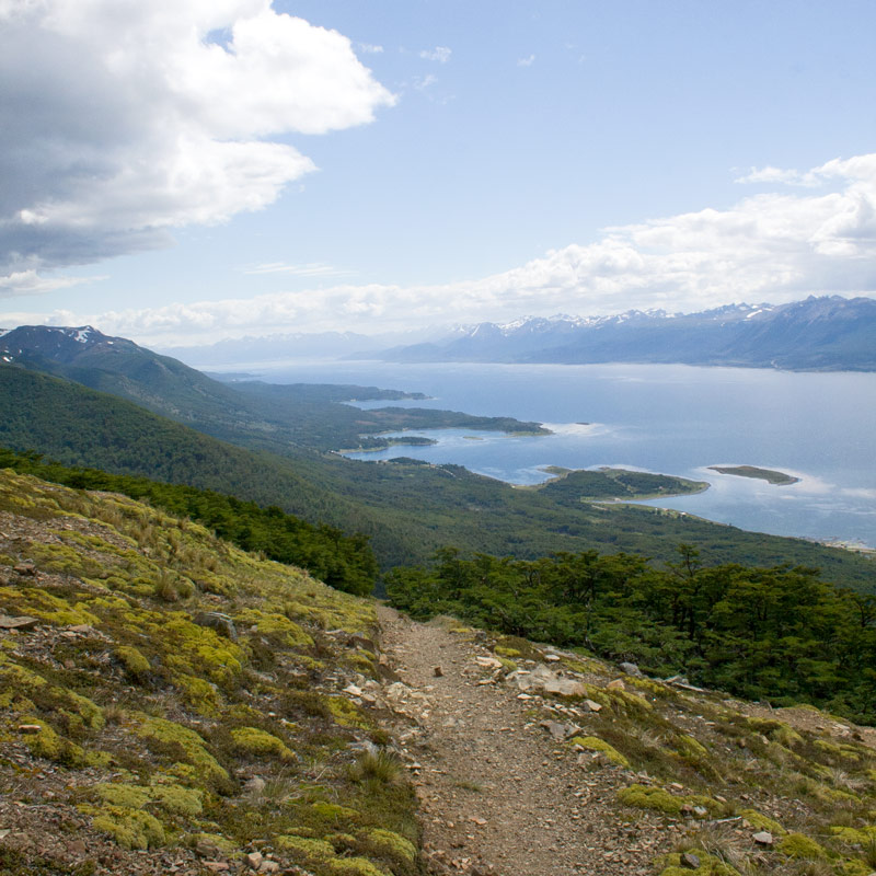
The trail continues under a lenga wood, a tree specific to the region. At the exit of the forest, the change of vegetation is abrupt, you have just passed the 600m of altitude which marks the end of the vegetative line. A 2nd mirador allows you to see as far as Ushuaia. Climb on your left until you reach the flag. A 3rd mirador towards the east allows you to have another angle of view. From the flag, the path is indicated by cairns. Follow the counterpart by staying on the “false flat” until after the lake.
From there, the path separates from the Los Dientes circuit and goes east. It is no longer marked. Stay on the side of the mountain, climbing steadily and aiming for the second peak. Arriving a little after the first summit, climb the slope to reach the ridge. Follow it to the summit.
You must always inform people at your accommodation where you are going to walk.
The start is 3.5 km from the centre of Puerto Williams. At the crossroads of the virgin take the track that goes south. Follow it for 2 km, keeping to the right at the fork in the road.
Duration* : 7h
Ascending:800m
Distance* : 12km
Difficulty:4/5
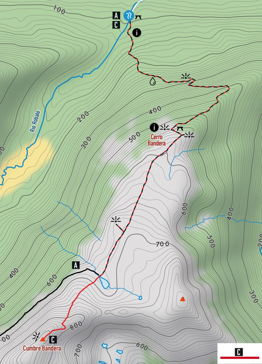 Find this hike on the map:
 Topographic map and hiking guide | Isla Navarino | Dientes de Navarino | Digital format Getting the map and GPS track