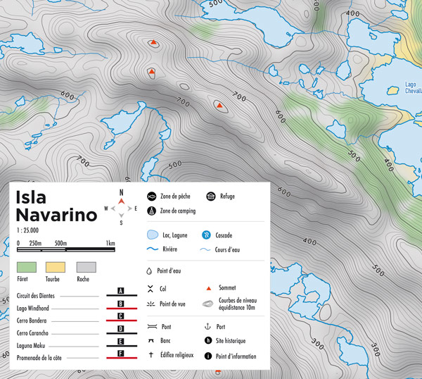
Topographic map and hiking guide | Isla Navarino | Dientes de Navarino | Digital format
5,00€
This pack includes :
- Digital version of the map (high-definition PDF)
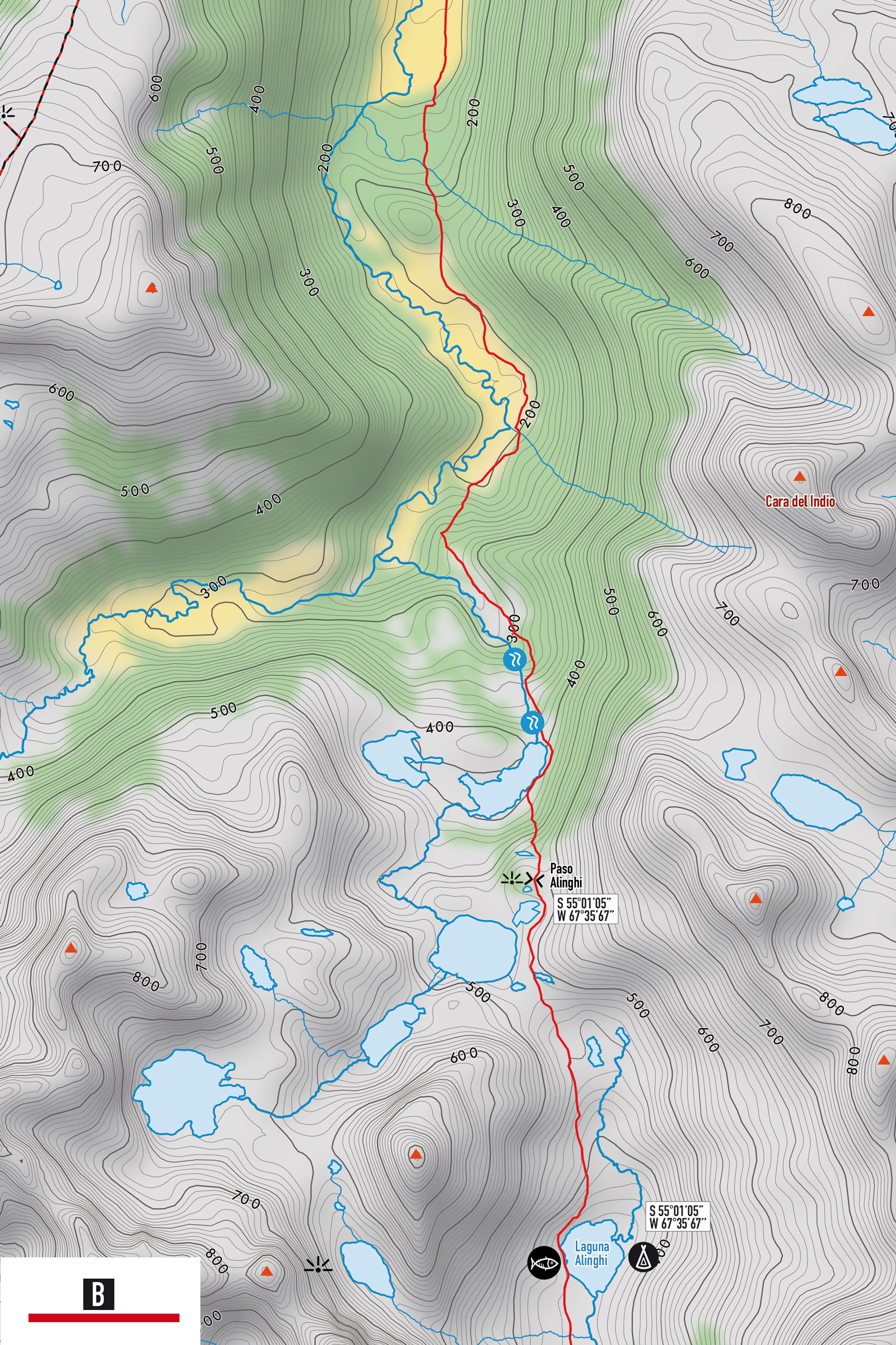
- GPS tracks of the walks (GPX format)
Technical information
- Colour map made from waterproof and tear-resistant paper (Stone paper)
- Format 50.4 × 71.41 cm – recto/verso
- Spanish language
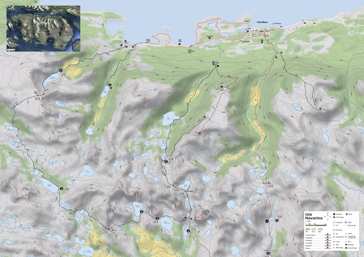
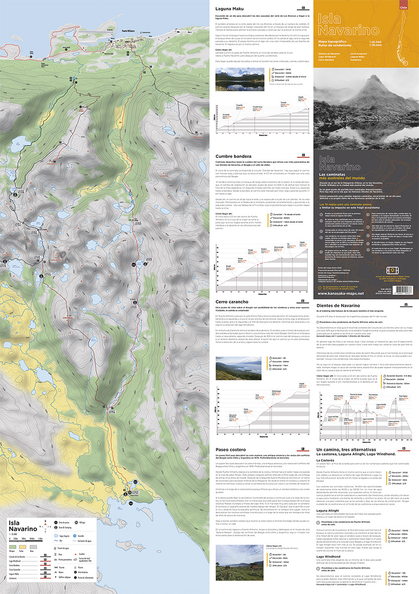
- 8 hiking trails
- Scale 1:25000 & 1:18000
- Free access to GPX tracks
- 10m contour lines
- Fishing / Camping / Refuge
Hiking
- Dientes de Navarino
- Lago Windhond
- Cumbre bandera
- Laguna Maku
- Laguna Alinghi
- La castorea
- Coastal walk
- Cerro Carancho
Specifications
- Version 2
- Map date: January 2023
- Projection pseudo Mercator / WGS 84
- Map background: OpenStreetMap.org
- Contours and shadows : OpenSnowMap.org
- Field information: NASA/CNES/Airbus aerial and satellite images