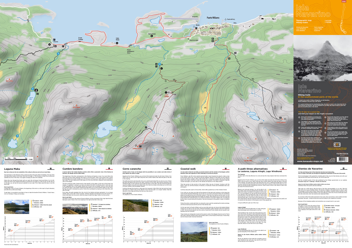
We have prepared some hikes for you,
day trips to enjoy your
rhythm of the magnificent paths of the island.
We have been exploring Isla Navarino for several years and have been working on hiking itineraries.
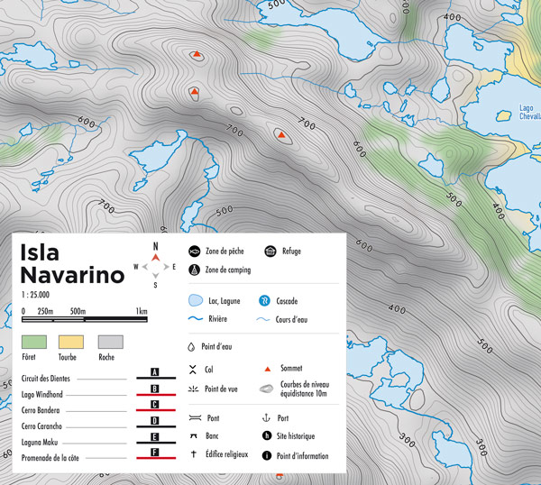
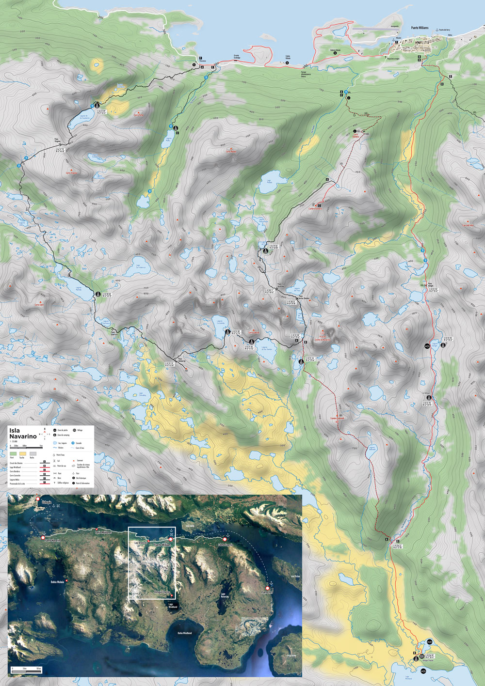
Dientes de Navarino
Lago Windhond
Laguna Maku
Cumbre bandera
La castorea
Laguna Alinghi
Coastal walk
Cerro Carancho
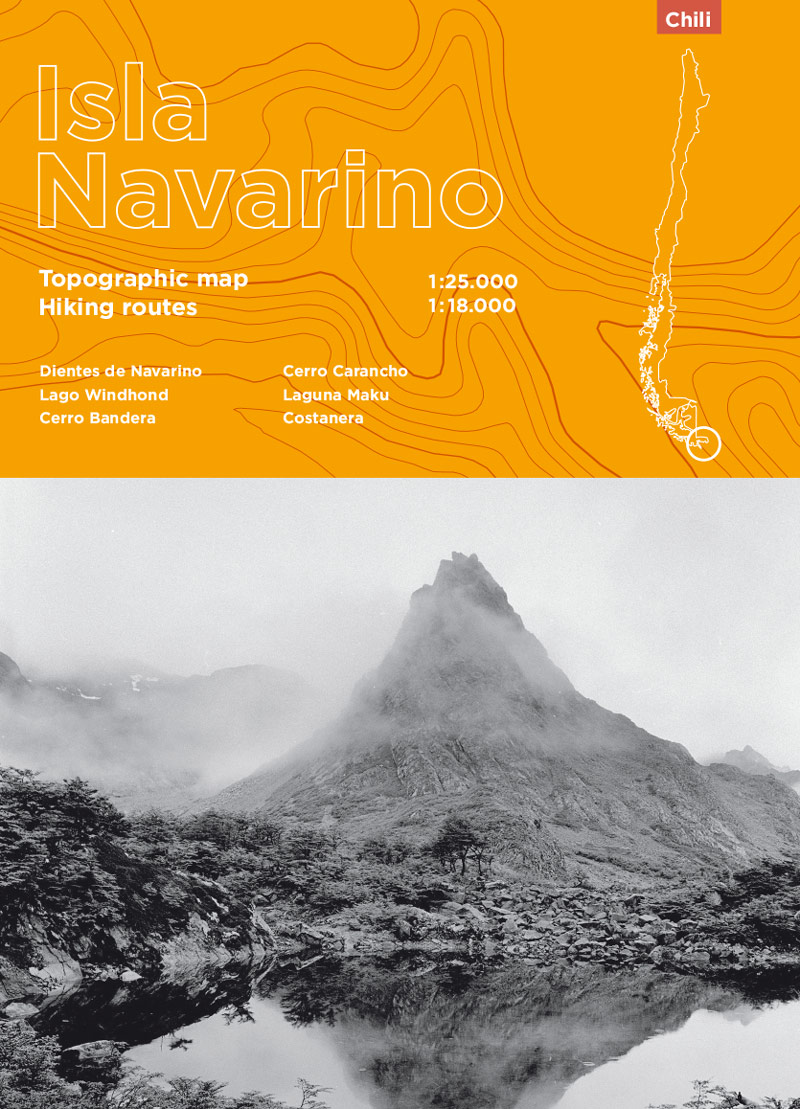
Paper & PDF Version
Format 50,4 × 71,41 cm / double-sided
8 hikes
Scale 1:25000 & 1:18000
Level curves at 10m
Provided with GPS tracks
Fishing / Camp / Refuge
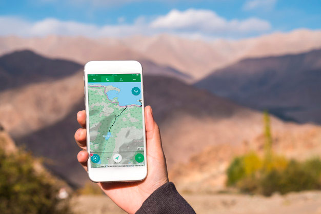
Our tracks are in GPX format.
They guarantee you the compatibility with all GPS
and mapping application.
Once loaded into your smartphone you will have access to your routes without a phone or data network. Simply load the tracks provided into your favorite application.


Map Date: January 2020
Projection pseudo Mercator / WGS 84
Map background: OpenStreetMap.org
Contours and shadows : OpenSnowMap.org
Field information: NASA/CNES/Airbus aerial and satellite images
We do not guarantee 100% the accuracy of the information on our card.